The Massachusetts Institute of Technology (MIT) and the Charles Stark Draper Laboratory (CSDL) have developed visual aided navigation technology that allows rescue or reconnaissance drones to achieve autonomous flight in environments where GPS signals are unreachable. In order to overcome the limitations of GPS signals, previous research attempts to use its navigation technology, such as LiDar, but none of them succeeded. In contrast, the technology developed by MIT and Draper does not rely on directional structure systems, motion capture systems, or maps as it has in the past. In addition, many alternatives are limited by the speed of the drone's 45mph – beyond the speed range of many onboard communication signals. The MIT and Draper researchers' solutions enable UAVs to work when first responders or soldiers operate UAVs in the basement, under the cover of dense forests, or in dense urban jungles such as high-rise buildings. Automatic control in an unknown environment. The research team at MIT and Draper Labs created a visually capable drone that navigates in a basement, forest, and urban jungle without GPS signals (Source: Charles Stark Draper Laboratory) The four-axle aircraft with sensors and cameras is sponsored by DARPA's "Fast Lightweight Autonomy" (FLA) program and has been tested for indoor and outdoor mixing, including cluttered and open environments. Simulate situations that UAVs may encounter when flying in an unknown environment without remote pilot operation. The research team said that the navigation method developed by Draper Lab combines visual and inertial sensing capabilities and forms a new state assessment approach: it can be used to estimate the position, direction and speed of drones. Researchers refer to this approach as "smoothing and mapping with inertial state estimation (SAMWISE)." Draper's SAMWISE sensor fusion algorithm allows drones to fly at 45 mph in unmapped, GPS-free environments (source: Charles Stark Draper Laboratory) The test drone uses a specific sensor and algorithm configuration, as well as a single-eye camera based on IMU navigation, which successfully maintains accurate position estimates while avoiding trees, locating building entrances, and entering and exiting buildings. This technology may also be suitable for other locations on the ground or underwater that cannot access GPS. MIT engineers have been developing a variety of autonomous robots and drone navigation for many years, including optical, RFID, and synchronous positioning and imaging (SLAM). Cummins Tube Brace,Cummins Oil Supply Tube,Cummins Wiring Harness,fuel supply pipeline Cummins Chongqing LDJM Engine Parts Center , http://www.ckcummins.com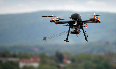
MIT and Draper Labs have jointly developed visual aided navigation technology, combined with visual algorithms and inertial sensors, allowing the drone to achieve autonomous flight in an environment where GPS signals cannot reach... 
